
Serving East Arthedain, Rivendell and The Shire since 1967
Latest News
Buckland remodelled
Buckland remodelled
Home
News
The Layout Control Systems
Maps & Diagrams
Motive Power
Rolling Stock
Train Services
Railway Preservation
Photos & Videos
Suppliers & Spares
Links
Control Systems
Maps & Diagrams
Motive Power
Rolling Stock
Train Services
Railway Preservation
Photos & Videos
Suppliers & Spares
Links
Introduction
Power Supply
CBUS
DCC
Decoder Stay Alive
Computer Control
Former Control System
Accessories
The Railway Schematic Network Map
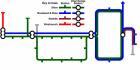 Company Network Map
 Regional Map
Create a map by clicking buttons to add and remove information, such as hills, forests, lakes and rivers, roads, railways, stations, political boundaries, towns and names.
 The Shire